The data is expected to help understand the impact of the rains and floods, as well as suggest remedial measures to the government.
Considering the inordinate amount of rainfall Chennai has been receiving over the last few days, a flood risk map for the Greater Chennai region has been revived. This is expected to help understand the impact of the rains and floods, as well as suggest remedial measures to the government. The project was first developed by the Urban Risk Lab at Massachusetts Institute of Technology (MIT) as a “free, transparent platform to harness civic sensing for collective disaster management” a few years ago. It had later been taken down before coming back online now. A professor from the Indian Institute of Technology (IIT) Madras is working on collating the information.
According to The Hindu, the map project was shelved in 2016-17, but has been revived at the request of the professor. Speaking to The Hindu, professor Balaji Narasimhan from IIT Madras, said, “We are working with Chennai Corporation and the State disaster mitigation agency to put together in place a real-time system. We are trying to collect as much data as possible.”
To utilise this feature, you need to have the Twitter app installed on your phones. Visit https://in.riskmap.org and click on ‘Share Report’ in the left corner. Then select Twitter and you will be directed to the riskmap chatbot. Click on ‘Report Flood’ to get a unique link and clicking on this link will open a map to get your exact coordinates (turn on location /GPS). You can then drag the slider to enter depth of flooding in the next screen and upload any location specific picture. You can also provide more information that may be helpful and use the slider to submit.
The National Disaster Response Force (NDRF), the state police department and revenue officials are on high alert after the India Meteorological Department (IMD) warned of heavy to very heavy rainfall in Chennai and several other districts of Tamil Nadu. A holiday has been declared for schools and colleges in Chennai and other districts for Wednesday, November 10 and Thursday, November 11.
As per the IMD rainfall warning for Chennai, moderate rainfall is likely in Guindy, Mambalam, Mylapore, Purasawalkam and Tondiarpet. The IMD had said on Tuesday that the low pressure area over Bay of Bengal is very likely to concentrate into a depression soon and bring widespread rainfall across Tamil Nadu for the next couple of days.
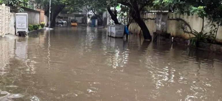
Chennai received some respite with the city witnessing 14.7 mm rainfall till 5.30 am on Wednesday, November 10. Chennai and nearby northern regions mostly saw light to moderate rainfall till Tuesday night. Waterlogging, however, continued in Chennai and in the suburbs in the wake of heavy rains from the night of November 6 till Monday.
Poondi, Puzhal, Cholavaram and Chembarambakkam lakes are the main drinking water sources for Chennai city and these are nearly full due to downpour in the catchment areas.
Original News Link
https://www.thenewsminute.com/article/iit-m-professor-creates-flood-risk-map-help-track-flooded-chennai-areas-157444